Regeneration framework

A regeneration framework is a document that brings together urban planning, transport and design to guide change in an area.

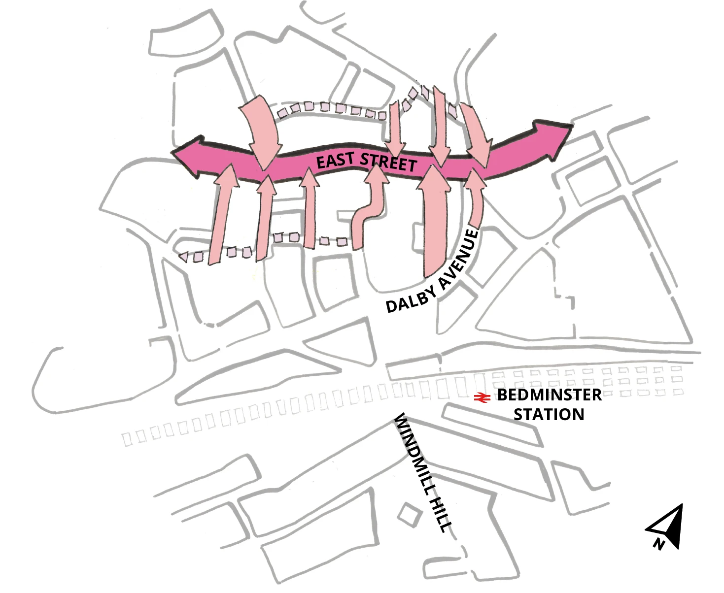
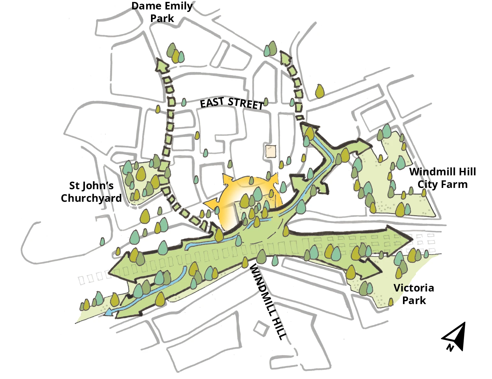
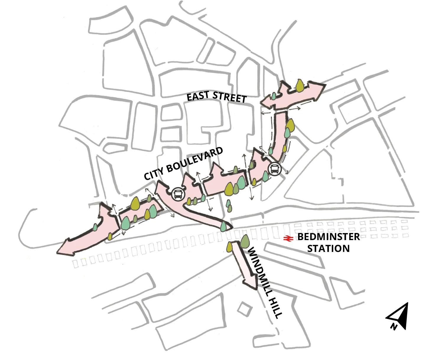
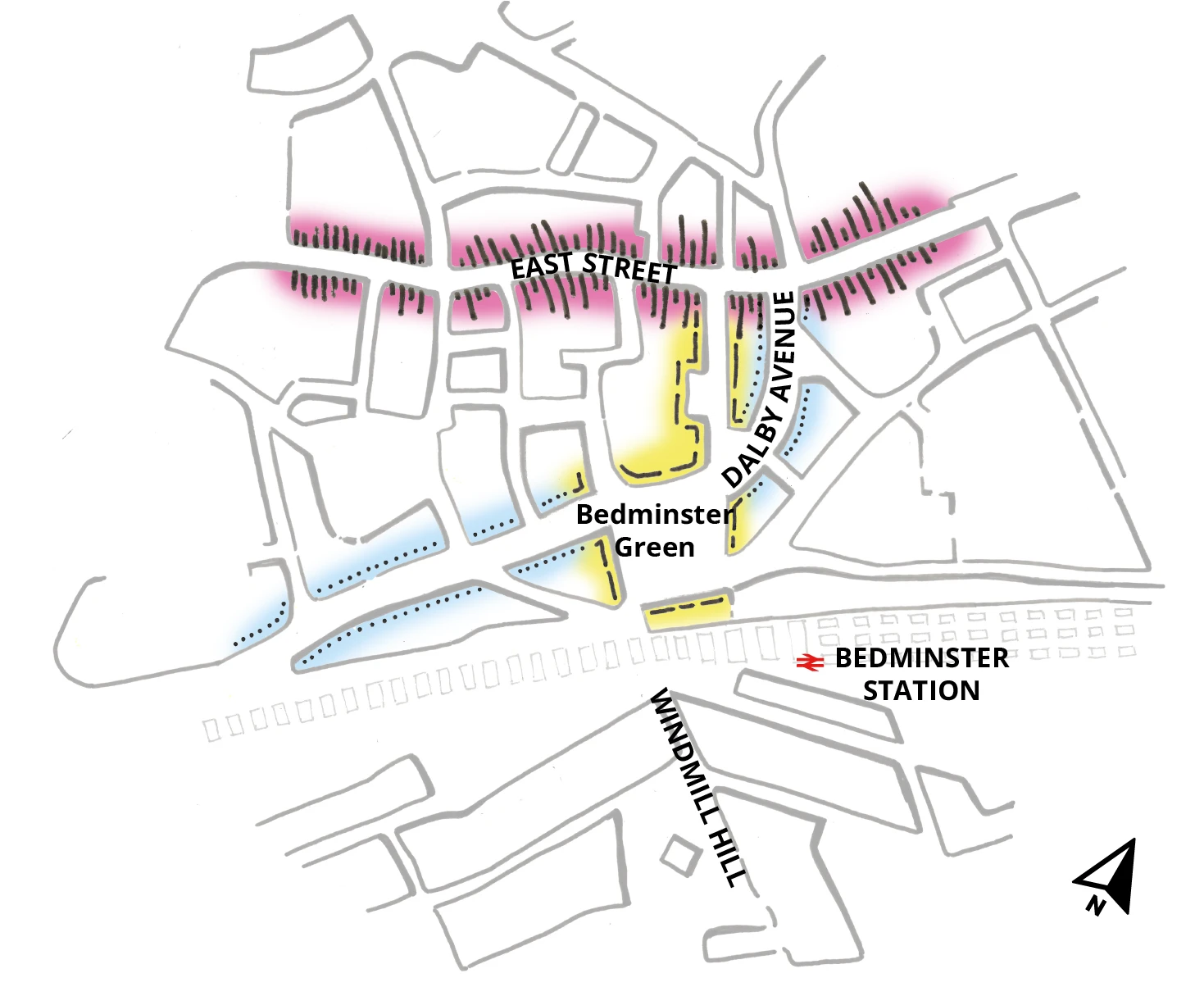
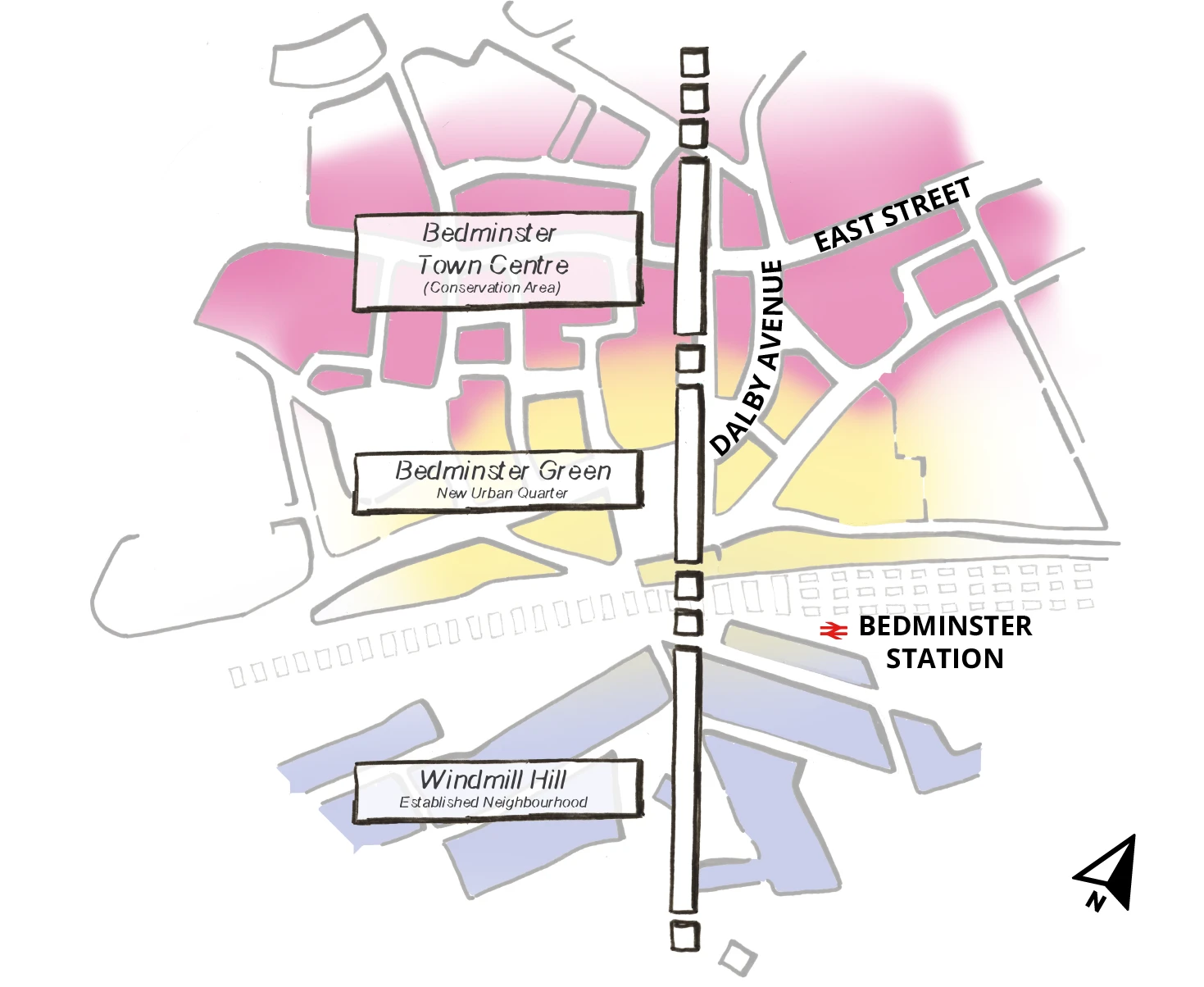
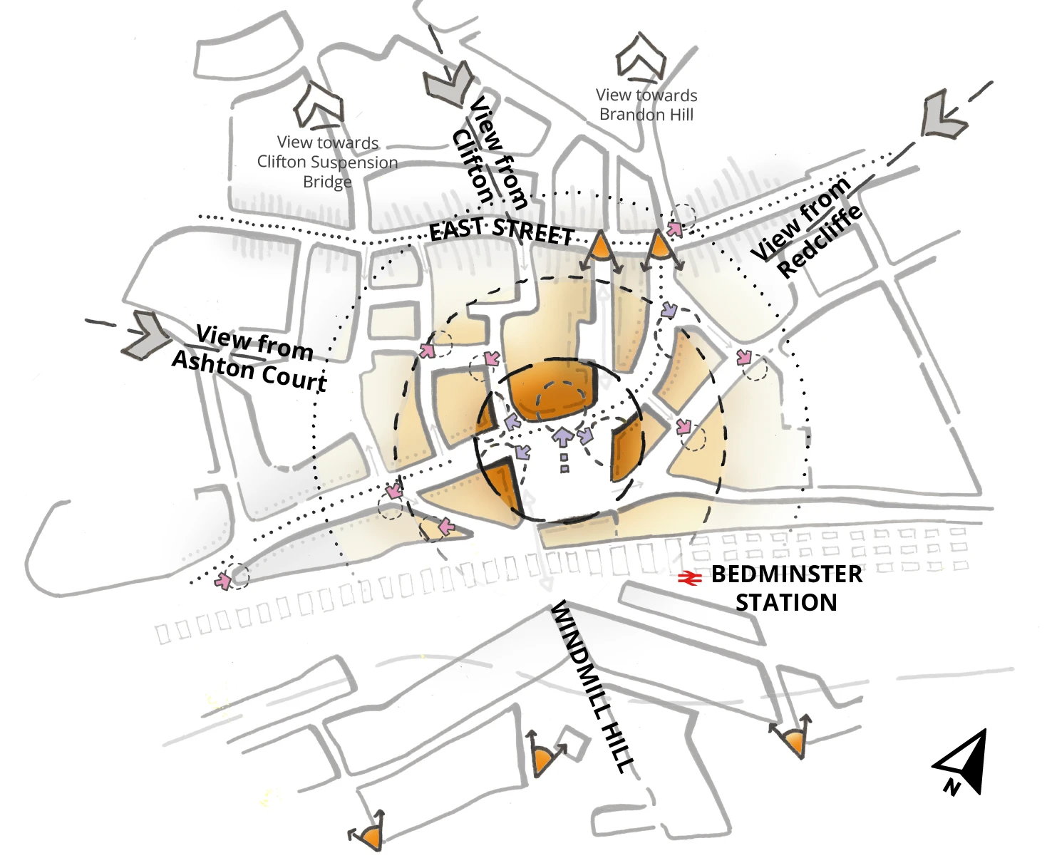
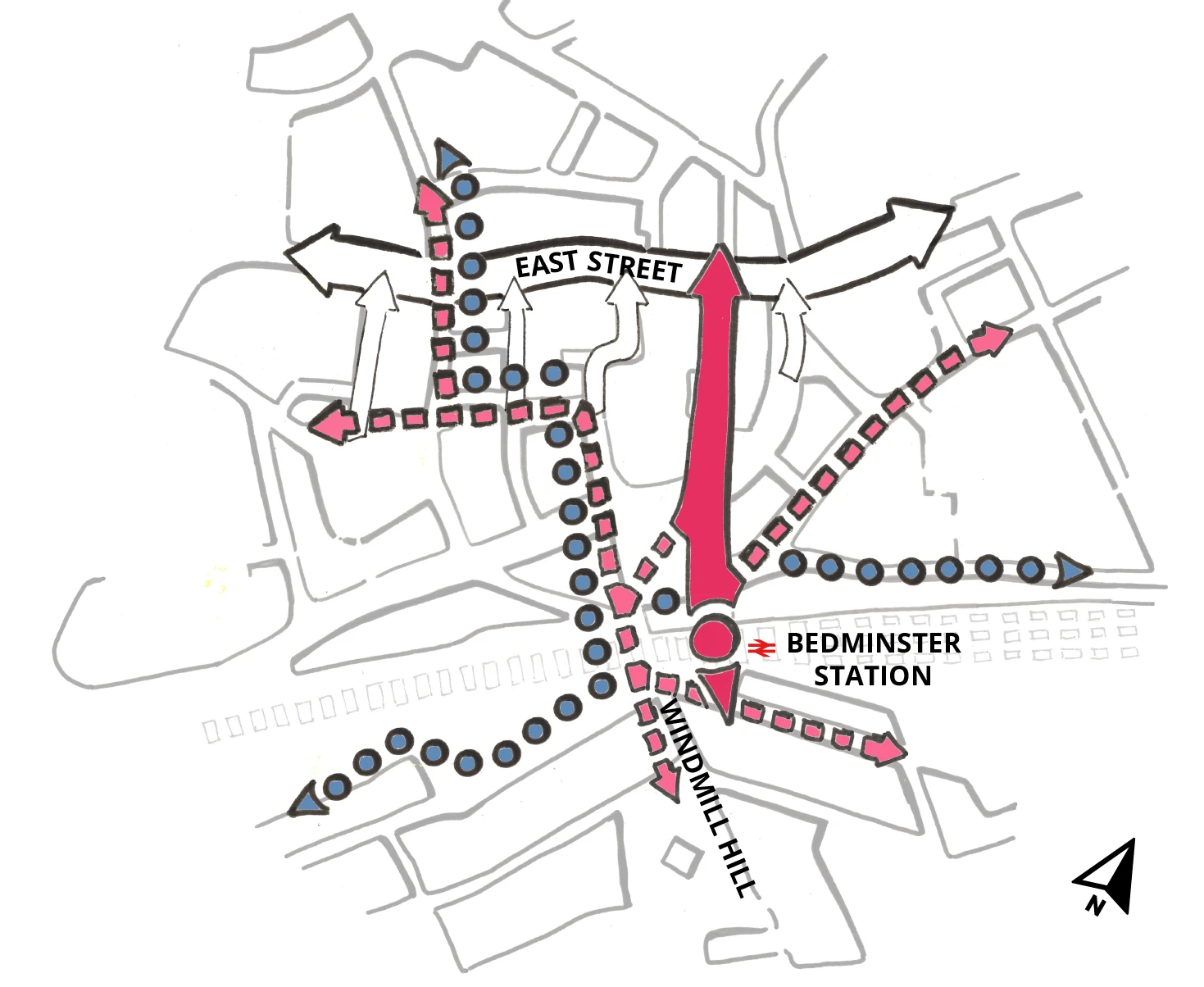
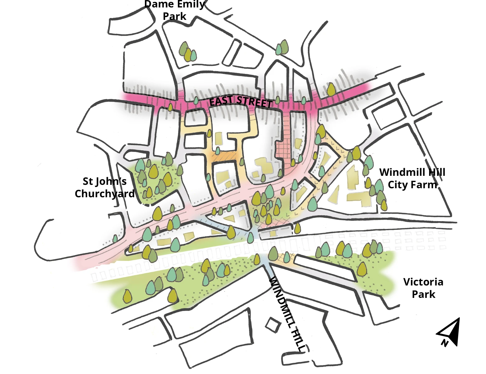
There are four aims for Bedminster Green which informed this regeneration framework, and they are supported by plans and diagrams to show proposals for future movement networks, land use and density, and public and open spaces. By taking an area-wide and holistic approach to managing change, regeneration frameworks can help to overcome and respond to complex challenges which extend beyond individual landownerships. Read more on Bedminster Green leading aims.

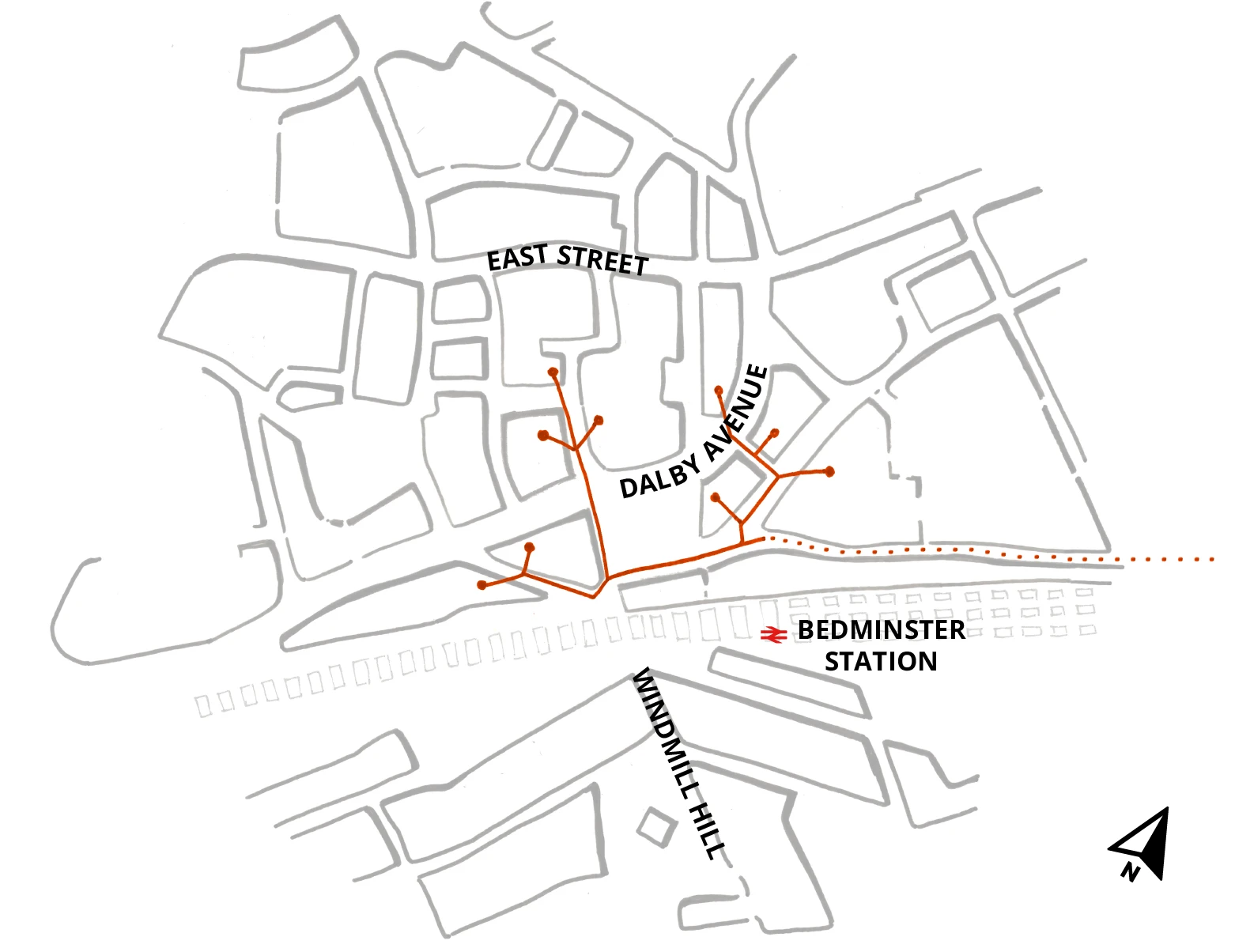
In 2019, we produced the Bedminster Green Framework – a roadmap for how development should happen within Bedminster Green. We pooled local knowledge and experiences with technical and design expertise to lay out a plan for the area. It sets out what kind of housing should be built, where it should be built, and what services and amenities those homes would need. The framework also details how these homes should be connected to their surroundings – to local bus and cycle routes, green spaces, and the low-carbon district heat network.

Read the full Bedminster Green Framework.

Regeneration principles

The base of this diagram, which is the same for all the framework diagrams, is a hand drawing showing the urban blocks of the wider Bedminster Green area – East Street is towards the top of the image, Dalby Avenue is in the middle, the railway and Bedminster station is below that and Windmill Hill is at the bottom. A large pink arrow is running along East Street and has several smaller pink arrows pointing towards it running along the adjoining streets. There are two dashed lines running parallel to East Street above and below on the smaller residential streets nearby.

Reinforcing East Street

The base of this diagram, which is the same for all the framework diagrams, is a hand drawing showing the urban blocks of the wider Bedminster Green area – East Street is towards the top of the image, Dalby Avenue is in the middle, the railway and Bedminster station is below that and Windmill Hill is at the bottom. A green area with multiple arrow heads runs along the railway line and Dalby Avenue with the arrow heads pointing to existing open spaces like Victoria Park and Windmill Hill City Farm. The proposed route of the River Malago in blue, shown on top of the green base. There are smaller, dashed green arrows that run from the green shape at the bottom up towards East Street.

Green network and the River Malago

The base of this diagram, which is the same for all the framework diagrams, is a hand drawing showing the urban blocks of the wider Bedminster Green area – East Street is towards the top of the image, Dalby Avenue is in the middle, the railway and Bedminster station is below that and Windmill Hill is at the bottom. A light pink arrow runs between Malago Road and Bedminster Parade. The arrow is lined with trees. Along the arrow there are smaller arrows that run along the adjoining roads with the most prominent one going along Windmill Hill.

Human scale for Dalby Avenue

The base of this diagram, which is the same for all the framework diagrams, is a hand drawing showing the urban blocks of the wider Bedminster Green area – East Street is towards the top of the image, Dalby Avenue is in the middle, the railway and Bedminster station is below that and Windmill Hill is at the bottom. Buildings along East Street are highlighted in pink, buildings along Dalby Avenue are highlighted in blue and buildings around Bedminster Green and St Catherine’s Place are highlighted in yellow.

Fronting and enclosing streets

The base of this diagram, which is the same for all the framework diagrams, is a hand drawing showing the urban blocks of the wider Bedminster Green area – East Street is towards the top of the image, Dalby Avenue is in the middle, the railway and Bedminster station is below that and Windmill Hill is at the bottom. The top of the diagram is highlighted in pink and labelled ‘Bedminster Town Centre’. The middle of the diagram is highlighted in yellow and labelled ‘Bedminster Green – New Urban Quarter’. The bottom of the diagram is highlighted blue and is labelled ‘Windmill Hill’.

Transitioning new and old neighbourhoods

The base of this diagram, which is the same for all the framework diagrams, is a hand drawing showing the urban blocks of the wider Bedminster Green area – East Street is towards the top of the image, Dalby Avenue is in the middle, the railway and Bedminster station is below that and Windmill Hill is at the bottom. The diagram shows a highlighted circle, on Bedminster Green, in the centre and rings fading outwards. It also shows arrows pointing towards the highlighted area to show incoming views and arrows pointing away from the highlighted area to show outward views.

A legible place

The base of this diagram, which is the same for all the framework diagrams, is a hand drawing showing the urban blocks of the wider Bedminster Green area – East Street is towards the top of the image, Dalby Avenue is in the middle, the railway and Bedminster station is below that and Windmill Hill is at the bottom. A large pink arrow runs north south from Bedminster station to East Street. Smaller dashed pink arrows and blue dotted arrows run along smaller streets.

Connecting the neighbourhood

The base of this diagram, which is the same for all the framework diagrams, is a hand drawing showing the urban blocks of the wider Bedminster Green area – East Street is towards the top of the image, Dalby Avenue is in the middle, the railway and Bedminster station is below that and Windmill Hill is at the bottom. East Street is highlighted in pink, with block fronts with dashed black lines. Moving down the diagram shows spaces within the white blocks filled with green shapes and tree symbols.

A network of spaces

The base of this diagram, which is the same for all the framework diagrams, is a hand drawing showing the urban blocks of the wider Bedminster Green area – East Street is towards the top of the image, Dalby Avenue is in the middle, the railway and Bedminster station is below that and Windmill Hill is at the bottom. Orange lines run along roads around the central Green. A dashed orange line runs along Whitehouse Street off to the right of the diagram.

Sustainable energy and clean air