Regeneration framework

A regeneration framework is a document that integrates urban planning, transport and design thinking to guide change in an area. They are made up of a series of principles or regeneration objectives and are supported by plans and diagrams to show proposals for future movement networks, land use and density, and public and open spaces. By taking an area-wide and holistic approach to managing change, regeneration frameworks can help to overcome and respond to complex challenges which extend beyond individual landownerships.

By creating a regeneration framework for Whitehouse Street, we are aiming to make sure changes to the area are coherent, and landowners can work collaboratively to transform the area in line with the long-term vision for change set out in the framework.

The Whitehouse Street Regeneration Framework became a live document within the planning process in March 2023. It now helps shape and determine planning applications.
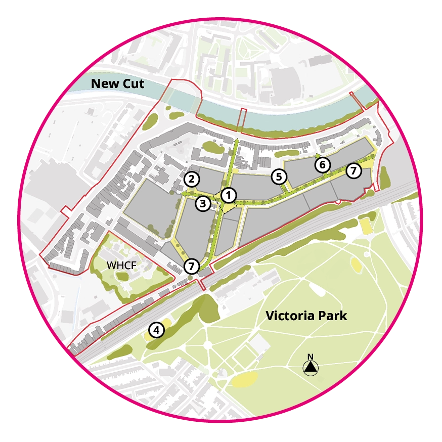
Read the Whitehouse Street Regeneration Framework.

Concept masterplan

The proposed concept plan.

Key

  • Development plots

  • Public realm improvements

  • Employment focus areas

  • Green corridor

  • Energy centre

Location key

  1. Potential public realm improvements to Philip Street and Stillhouse Lane.
  2. Location of new BCC district energy centre.
  3. Proposed new pedestrian connection from Windmill Close to Willway Street.
  4. Improvements to Windmill Hill and St Luke’s Road railway underbridges. Short term interventions could include new lighting or public art.
  5. Improvements to children’s play space in Victoria Park.
  6. Potential sustainable transport improvements to Bedminster Bridge.
  7. Potential for ‘hotspot’ of non-residential uses.
  8. East-west connection along Princess Street with green infrastructure including street trees, planters, swales and open green space.
  9. Improvements to north-south connection along Whitehouse Street.
  10. Distance from existing buildings and screening by well established trees mean this is an area with potential for extra height.
  11. A new pedestrian and cycle connection from Princess Street to St Luke’s Road.
  12. Potential improvements to Langton Street Bridge.
  13. Community growing space or children’s play space.
  14. The option for a new pedestrian and cycle bridge over the New Cut will be considered in future to improve cycling and walking routes.
  15. Indicative location of pedestrian connection from Willway Street to Stillhouse Lane.
  16. Widened street with improved footways, planting and street trees on Sargent Street.
A new mid-rise development in Strasbourg with a park in front.

Themes, principles, outcomes

The regeneration framework identifies four themes which address the needs of the community manifesto and project brief. From these themes follow a set of six principles which structure the regeneration framework. Embedding the principles into design is anticipated to deliver a set of outcomes for the regeneration.

Regeneration principles

A plan showing the extent of the planned Bedminster Hear Network. The first phase, which is currently being installed is shown around the Bedminster Green development. The Whitehouse Street and Mead Street Regeneration Areas are shown as a second phase. A third phase includes Asda and new developments in central Bedminster. A energy centre is shown located on the corner of Willway Street. A temporary energy centre is shown next to the junction of Whitehouse Street and New Queen Street.

Climate change and sustainability

Plan showing the proposed movement strategy. The plan shows new a new east-west active travel route connecting Whitehouse Street to St Luke’s Road, and onward via Mead Street. The existing cycle track on Whitehouse Lane is shown connecting to the planned cycle track on Whitehouse Lane. New pedestrian connections are proposed from Whitehouse Street to Willway street, from Willway Street to Stillhouse Lane, and Spring Street to St Luke’s Road. A number of roads, including Philip Street, are shown as one way movements. Improvements to the public realm are identified for Philip Street, the alleys on Stillhouse Lane, and the railway underbridges. Potential improvements are shown on Langton Street Bridge (accessibility) and Bedminster Bridge (sustainable travel). The indicative location of tow multimodal mobility hubs are shown on St Luke’s Road and Whitehouse Street.

Transport and movement

Plan showing the proposed townscape strategy. This shows four broad character areas within the regeneration area. 1) Philip Street is identified for potential public realm improvements for pedestrians and cyclists, and to improve the setting of Windmill Hill City Farm. 2) Whitehouse Street and Princess street are identified as principal streets that will have an important movement function for people on foot, bike or scooter. They will be characterised by generous footways, well defined frontages and street trees. 3) The edge of the core regeneration area along Stillhouse Lane and the back of York Road will provide a transition from the scale and character of the existing context to that of the new neighbourhood. The character of Stillhouse Lane will be retained and enhanced. 4) The Willway Street area will bring together a variety of new and existing businesses, new and historic buildings, new homes and community space.

Placemaking and character

Plan showing the proposed heights and massing strategy. The viewpoint in Victoria Park is indicated, with the direction of views to the suspension bridge, Brandon Hill and St Mary Redcliffe shown. The plan shows three broad height categories. 1) At the edge of the core regeneration area along Stillhouse Lane, the back of York Road and behind existing homes, new development will be expected to correspond to the prevailing height in the area of around 3-4 storeys. 2) In the centre of the site, development will be expected to be appropriate up to an amplified height of 4-8 storeys, depending on context. 3) In an area between railway and Princess Street, an area with potential for taller buildings of greater than 8 storeys is indicated. Taller buildings will have to be contextual and demonstrate high quality design.

Height, scale and massing

Plan showing the proposed employment strategy. The existing businesses along the southern part of Willway Street are expected to remain. The council are working with Help Bristol’s Homeless to find a new home. Commercial or community spaces will provide active frontages to the central public space. Plot 1a, between Whitehouse Street and Willway Street, is identified as a location with an employment focus, including light industrial workspace. The centre of the site is shown as a possible location of a community space. The council are working with Help Bristol’s Homeless, (located on Spring Street) to find a new home.

Land use and employment

Plan showing the proposed movement strategy. The plan shows new a new east-west active travel route connecting Whitehouse Street to St Luke’s Road, and onward via Mead Street. The existing cycle track on Whitehouse Lane is shown connecting to the planned cycle track on Whitehouse Lane. New pedestrian connections are proposed from Whitehouse Street to Willway street, from Willway Street to Stillhouse Lane, and Spring Street to St Luke’s Road. A number of roads, including Philip Street, are shown as one way movements. Improvements to the public realm are identified for Philip Street, the alleys on Stillhouse Lane, and the railway underbridges. Potential improvements are shown on Langton Street Bridge (accessibility) and Bedminster Bridge (sustainable travel). The indicative location of tow multimodal mobility hubs are shown on St Luke’s Road and Whitehouse Street.

Public realm and green infrastructure